- Duration: 2 days
- Level: Advanced in 3D / BIM spatial analysis
- Teaching methods: Face-to-face, Remote
- Prerequisite: ArcGIS Pro Initiation training
- Provision of the software: no
- Location: Paris, Lyon, La Rochelle, Geneva (individual) or within your country / company
- Accessibility: arx iT is committed to facilitating access to its training courses for people with disabilities, and to implementing the necessary educational, material and organizational adaptations.
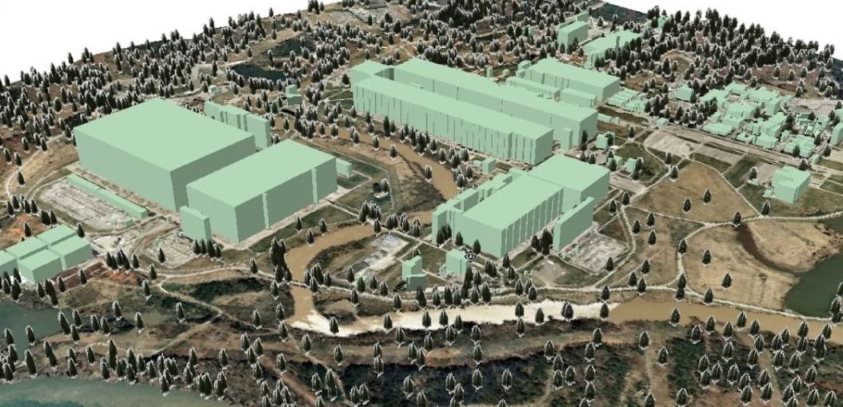
This ArcGIS Pro / 3D Analyst / BIM Extension training session allows trainees to work with Vector and Raster spatial data in 3D, whether for processing raw data (Digital Terrain Model, etc.) or for 3D visualization and simulation.
By the end of this course, participants will be able to:
- State of the art of BIM standardization
- SIG formats and BIM formats, 3D/BIM/SIG convergence
- Visualize 3D data with ArcGIS Pro
- Create 3D symbology
- Manage views and link 2D and 3D views
- Import BIM models into ArcGIS Pro
- Visualize and navigate BIM models with ArcGIS Pro
- Integrate a BIM model into an ESRI GIS environment
- Introduction to ArcGIS Online
- Building scene layers (Construction)
- Create Experience Builder applications
- Export BIM data with ArcGIS Pro
- Methods for validating a BIM model